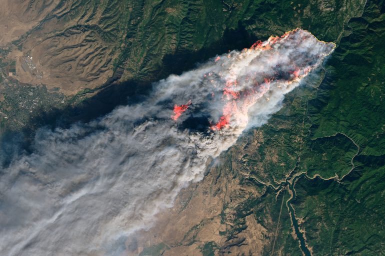
NASA’s Operational Land Imager satellite image of Camp Fire burning
NASA’s Operational Land Imager satellite image shows the Camp Fire burning at around 10:45 a.m. local time near Paradise, California. Courtesy NASA/via REUTERS
MOST POPULAR
Most Popular
This website uses cookies to ensure you get the best experience on our website, as well as for advertising and analytic purposes, to learn more, please review our Privacy Policy. Learn more